
चित्र:Tehri Garhwal zoomed in.jpg

इससे बड़ा रेसोल्यूशन उपलब्ध नहीं हैं।
Tehri_Garhwal_zoomed_in.jpg ((514 × 350 पिक्सेल, फ़ाइल का आकार: 70 KB, MIME प्रकार: image/jpeg))
|
|
यह फ़ाइल विकिमेडिया कॉमन्स से है। वहाँ पर इसका विवरण पृष्ठ निम्नोक्त है। कॉमन्स मुक्त लाइसेंसों के अंतर्गत उपलब्ध मीडिया फ़ाइलों का संग्रह है। आप भी इसमें मदद कर सकते हैं। |
सारांश
| विवरण |
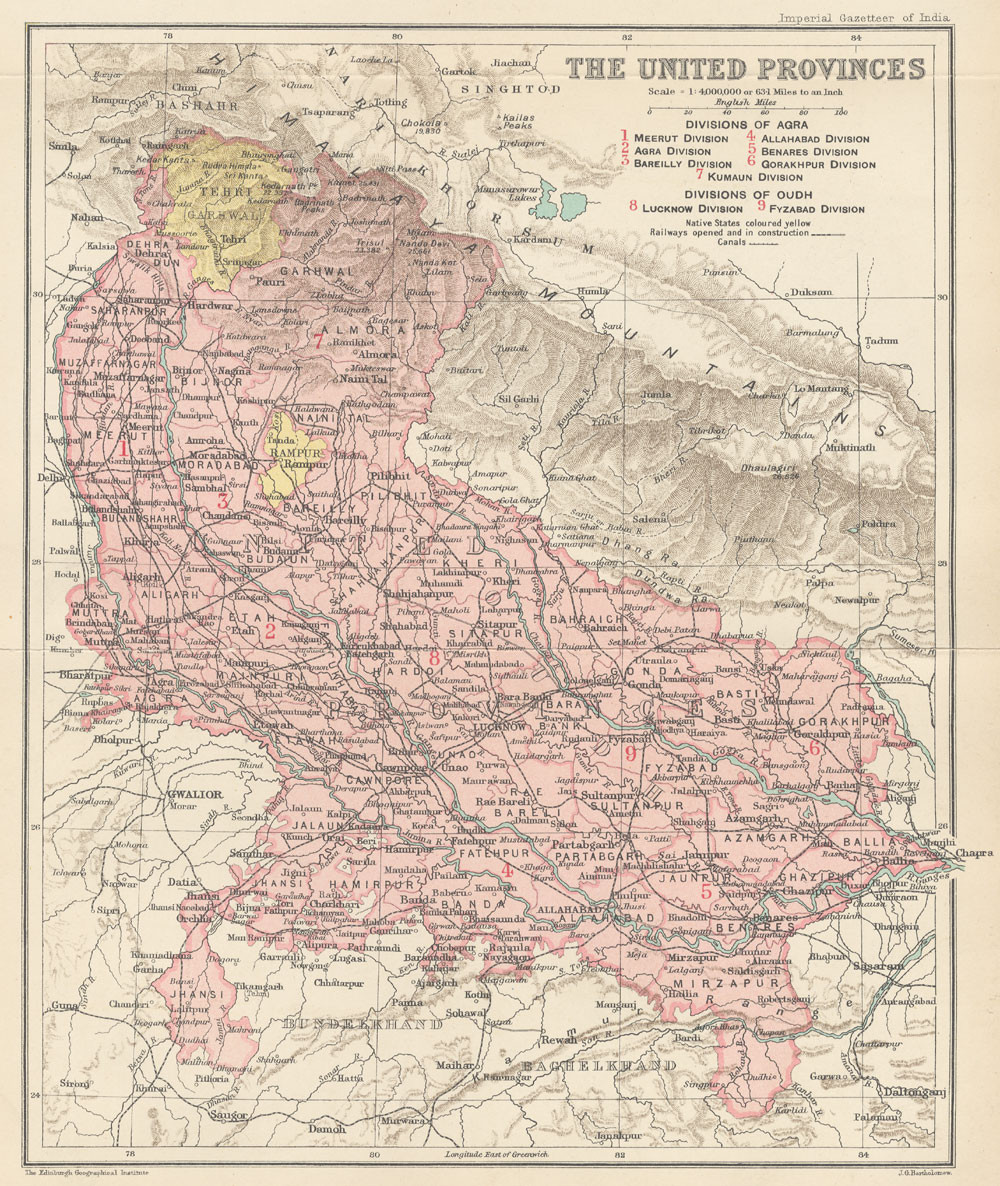
English: This is the map of Tehri Garhwal state made by British cartographer John G Bartholomew |
| दिनांक | १९०७ और १९०९ के बीच |
| स्रोत | https://dsal.uchicago.edu/maps/gazetteer/images/gazetteer_V24_pg250.jpg |
| लेखक | John G Bartholomew |
लाइसेंस
The author died in 1920, so this work is in the public domain in its country of origin and other countries and areas where the copyright term is the author's life plus 100 years or fewer. | |
| इस फ़ाइल को कॉपीराइट कानूनों के अंतर्गत सभी संबंधित अधिकारों समेत ज्ञात सीमाओं से मुक्त पहचाना गया है। | |
चित्र का इतिहास
फ़ाइलका पुराना अवतरण देखने के लिये दिनांक/समय पर क्लिक करें।
| दिनांक/समय | थंबनेल | आकार | सदस्य | प्रतिक्रिया | |
|---|---|---|---|---|---|
| वर्तमान | 12:19, 23 जुलाई 2020 | | 514 × 350 (70 KB) | Abhishek0831996 | |
| 12:00, 23 जुलाई 2020 |  | 360 × 316 (44 KB) | Abhishek0831996 | Uploaded a work by John G Bartholomew from https://dsal.uchicago.edu/maps/gazetteer/images/gazetteer_V24_pg250.jpg with UploadWizard |
चित्र का उपयोग
निम्नलिखित पन्ने इस चित्र से जुडते हैं :
चित्र का वैश्विक उपयोग
इस चित्र का उपयोग इन दूसरे विकियों में किया जाता है:
- bn.wikipedia.org पर उपयोग
- de.wikipedia.org पर उपयोग
- en.wikipedia.org पर उपयोग
- id.wikipedia.org पर उपयोग
- ja.wikipedia.org पर उपयोग
- ne.wikipedia.org पर उपयोग
- pnb.wikipedia.org पर उपयोग
- ta.wikipedia.org पर उपयोग
- uk.wikipedia.org पर उपयोग
- ur.wikipedia.org पर उपयोग