
चित्र:Map of Moradabad (1955).jpg
इससे बड़ा रेसोल्यूशन उपलब्ध नहीं हैं।
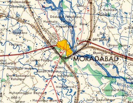
Map_of_Moradabad_(1955).jpg ((534 × 416 पिक्सेल, फ़ाइल का आकार: 97 KB, MIME प्रकार: image/jpeg))
|
|
यह फ़ाइल विकिमेडिया कॉमन्स से है। वहाँ पर इसका विवरण पृष्ठ निम्नोक्त है। कॉमन्स मुक्त लाइसेंसों के अंतर्गत उपलब्ध मीडिया फ़ाइलों का संग्रह है। आप भी इसमें मदद कर सकते हैं। |
सारांश
| विवरण |
English: Map of Moradabad (1955); Cropped from this file. |
| दिनांक | |
| स्रोत | File:Map India and Pakistan 1-250,000 Tile NH 44-13 Bareilly.jpg |
| लेखक | U.S. Army Map Service |
| दूसरे संस्करण |

.jpg)
लाइसेंस
This work is in the public domain in the United States because it is a work prepared by an officer or employee of the United States Government as part of that person’s official duties under the terms of Title 17, Chapter 1, Section 105 of the US Code.
Note: This only applies to original works of the Federal Government and not to the work of any individual U.S. state, territory, commonwealth, county, municipality, or any other subdivision. This template also does not apply to postage stamp designs published by the United States Postal Service since 1978. (See § 313.6(C)(1) of Compendium of U.S. Copyright Office Practices). It also does not apply to certain US coins; see The US Mint Terms of Use.
|
 | |
| इस फ़ाइल को कॉपीराइट कानूनों के अंतर्गत सभी संबंधित अधिकारों समेत ज्ञात सीमाओं से मुक्त पहचाना गया है। | ||
चित्र का इतिहास
फ़ाइलका पुराना अवतरण देखने के लिये दिनांक/समय पर क्लिक करें।
| दिनांक/समय | थंबनेल | आकार | सदस्य | प्रतिक्रिया | |
|---|---|---|---|---|---|
| वर्तमान | 17:41, 5 दिसम्बर 2019 | | 534 × 416 (97 KB) | ArmouredCyborg | User created page with UploadWizard |
चित्र का उपयोग
इस चित्र से कोई पन्ने नहीं जुड़ते
चित्र का वैश्विक उपयोग
इस चित्र का उपयोग इन दूसरे विकियों में किया जाता है:
- en.wikipedia.org पर उपयोग
- te.wikipedia.org पर उपयोग
- yo.wikipedia.org पर उपयोग
.jpg)