
चित्र:Wrynose Pass, Three Shires Stone - geograph.org.uk - 919622.jpg
इस पूर्वावलोकन का आकार: 450 × 600 पिक्सेल। दूसरे रेसोल्यूशन्स: 180 × 240 पिक्सेल | 480 × 640 पिक्सेल।
मूल चित्र ((480 × 640 पिक्सेल, फ़ाइल का आकार: 118 KB, MIME प्रकार: image/jpeg))
|
|
यह फ़ाइल विकिमेडिया कॉमन्स से है। वहाँ पर इसका विवरण पृष्ठ निम्नोक्त है। कॉमन्स मुक्त लाइसेंसों के अंतर्गत उपलब्ध मीडिया फ़ाइलों का संग्रह है। आप भी इसमें मदद कर सकते हैं। |
सारांश
| विवरण |
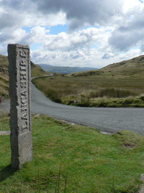
English: Wrynose Pass: Three Shires Stone This stone marks what was, until 31 March 1974, the meeting point of the counties of Lancashire, Cumberland and Westmorland. It is now wholly within Cumbria. |
| दिनांक | |
| स्रोत | From geograph.org.uk |
| लेखक | Chris Downer |
| श्रेय (required by the license) | Chris Downer / Wrynose Pass: Three Shires Stone / |
| कैमरा स्थान | | यह और अन्य आसपास की छवियों यहां पर देखें: ओपन स्ट्रीट मैप |
|---|
_heading:90.00&language=hi)
| वस्तु स्थान | | यह और अन्य आसपास की छवियों यहां पर देखें: ओपन स्ट्रीट मैप |
|---|
_heading:90.00&language=hi)
लाइसेंस

|
This image was taken from the Geograph project collection. See this photograph's page on the Geograph website for the photographer's contact details. The copyright on this image is owned by Chris Downer and is licensed for reuse under the Creative Commons Attribution-ShareAlike 2.0 license.
|
इस फ़ाइल को क्रिएटिव कॉमन्स श्रेय-समानसांझा 2.0 साधारण लाइसेंस के अंतर्गत लाइसेंस किया गया है।
श्रेय: Chris Downer
- आप खुलकर:
- बाँट सकते हैं – रचना की प्रतिलिपि बना सकते हैं, बाँँट सकते हैं और संचारित कर सकते हैं
- रीमिक्स कर सकते हैं – कार्य को अनुकूलित कर सकते हैं
- निम्नलिखित शर्तों के अंतर्गत:
- श्रेय – यह अनिवार्य है कि आप यथोचित श्रेय प्रदान करें, लाइसेंस की कड़ी प्रदान करें, और अगर कोई बदलाव हुए हों तो उन्हें इंगित करें। आप ऐसा किसी भी उचित तरीके से कर सकते हैं, लेकिन किसी भी तरह उससे यह नहीं संकेत नहीं किया जाना चाहिए कि लाइसेंसधारी द्वारा आपको अथवा आपके इस प्रयोग का समर्थन किया जा रहा हो।
- समानसांझा – अगर आप इस रचना में कोई बदलाव करते हैं या इसपर आधारित कुछ रचित करते हैं तो आप अपने योगदान को सिर्फ इसी या इसके सामान किसी लाइसेंस के अंतर्गत बाँट सकते हैं।
चित्र का इतिहास
फ़ाइलका पुराना अवतरण देखने के लिये दिनांक/समय पर क्लिक करें।
| दिनांक/समय | थंबनेल | आकार | सदस्य | प्रतिक्रिया | |
|---|---|---|---|---|---|
| वर्तमान | 00:44, 22 फ़रवरी 2011 | | 480 × 640 (118 KB) | GeographBot | == {{int:filedesc}} == {{Information |description={{en|1=Wrynose Pass: Three Shires Stone This stone marks what was, until 31 March 1974, the meeting point of the counties of Lancashire, Cumberland and Westmorland. It is now wholly within Cumbria.}} |date |
चित्र का उपयोग
इस चित्र से कोई पन्ने नहीं जुड़ते
चित्र का वैश्विक उपयोग
इस चित्र का उपयोग इन दूसरे विकियों में किया जाता है:
- de.wikipedia.org पर उपयोग
- en.wikipedia.org पर उपयोग
- fr.wikipedia.org पर उपयोग
- www.wikidata.org पर उपयोग