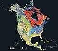
चित्र:North america terrain 2003 time scale.jpg

इस पूर्वावलोकन का आकार: 374 × 599 पिक्सेल। दूसरे रेसोल्यूशन्स: 150 × 240 पिक्सेल | 299 × 480 पिक्सेल | 672 × 1,077 पिक्सेल।
मूल चित्र ((672 × 1,077 पिक्सेल, फ़ाइल का आकार: 324 KB, MIME प्रकार: image/jpeg))
चित्र का इतिहास
फ़ाइलका पुराना अवतरण देखने के लिये दिनांक/समय पर क्लिक करें।
| दिनांक/समय | थंबनेल | आकार | सदस्य | प्रतिक्रिया | |
|---|---|---|---|---|---|
| वर्तमान | 16:01, 16 सितंबर 2005 |  | 672 × 1,077 (324 KB) | Saperaud~commonswiki | This is the time scale for the North America Tapestry of Time and Terrain map. <gallery> Image:North america terrain 2003 map.jpg </gallery> == Source == thumb|left|[[North America Tapestry of Time and Terra |
चित्र का उपयोग
इस चित्र से कोई पन्ने नहीं जुड़ते
चित्र का वैश्विक उपयोग
इस चित्र का उपयोग इन दूसरे विकियों में किया जाता है:
- en.wikipedia.org पर उपयोग
- en.wikiversity.org पर उपयोग


