
चित्र:USGS-Mars-MC-28-HellasRegion-mola.png
इस पूर्वावलोकन का आकार: 600 × 600 पिक्सेल। दूसरे रेसोल्यूशन्स: 240 × 240 पिक्सेल | 480 × 480 पिक्सेल | 768 × 768 पिक्सेल | 1,024 × 1,024 पिक्सेल | 2,048 × 2,048 पिक्सेल | 2,999 × 2,999 पिक्सेल।
मूल चित्र ((2,999 × 2,999 पिक्सेल, फ़ाइल का आकार: 7.79 MB, MIME प्रकार: image/png))
|
|
यह फ़ाइल विकिमेडिया कॉमन्स से है। वहाँ पर इसका विवरण पृष्ठ निम्नोक्त है। कॉमन्स मुक्त लाइसेंसों के अंतर्गत उपलब्ध मीडिया फ़ाइलों का संग्रह है। आप भी इसमें मदद कर सकते हैं। |
सारांश
| विवरण |
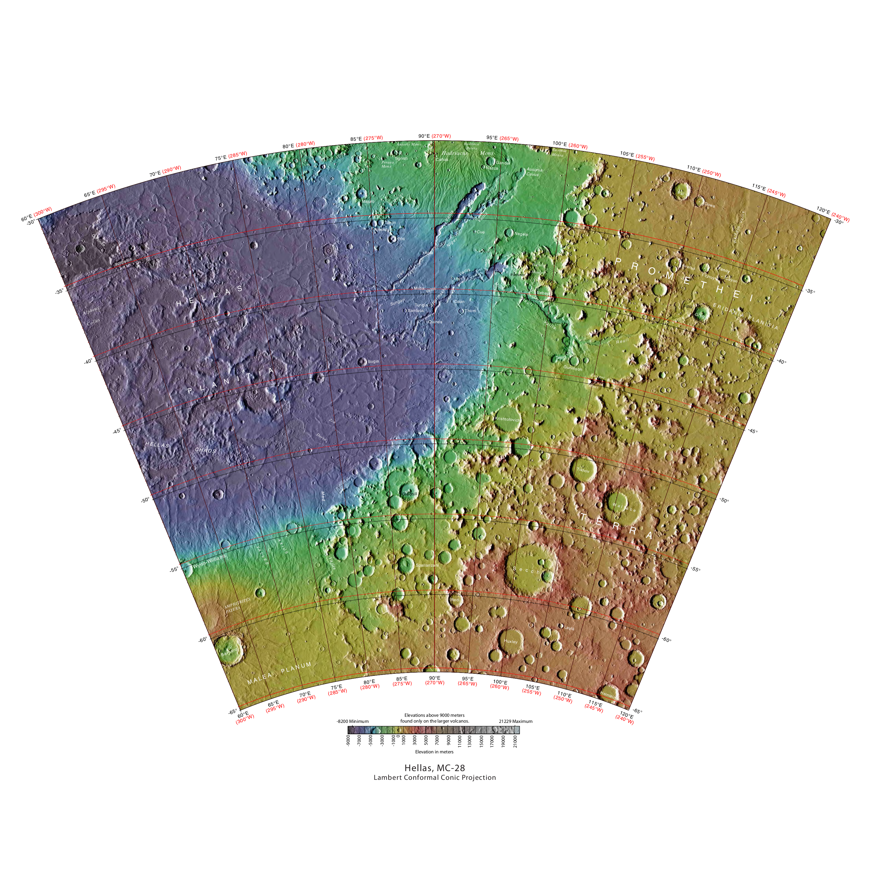
English: MOLA Topographic Map of Hellas Quadrangle (MC-28) on the planet Mars. NOTE: Converted the original PDF file to a PNG File (via GIMP v2.8.4 program) - and uploaded to Wikimedia Commons. |
| दिनांक | 08/27/2012 09:23:30 AM |
| स्रोत | http://planetarynames.wr.usgs.gov/images/mc28_mola.pdf |
| लेखक | USGS (United States Geological Survey) |
लाइसेंस
This image is in the public domain in the United States because it only contains materials that originally came from the United States Geological Survey, an agency of the United States Department of the Interior. For more information, see the official USGS copyright policy.
|
चित्र का इतिहास
फ़ाइलका पुराना अवतरण देखने के लिये दिनांक/समय पर क्लिक करें।
| दिनांक/समय | थंबनेल | आकार | सदस्य | प्रतिक्रिया | |
|---|---|---|---|---|---|
| वर्तमान | 20:13, 17 मई 2013 | | 2,999 × 2,999 (7.79 MB) | Drbogdan | User created page with UploadWizard |
चित्र का उपयोग
निम्नलिखित पन्ने इस चित्र से जुडते हैं :
चित्र का वैश्विक उपयोग
इस चित्र का उपयोग इन दूसरे विकियों में किया जाता है:
- ar.wikipedia.org पर उपयोग
- ca.wikipedia.org पर उपयोग
- cs.wikipedia.org पर उपयोग
- en.wikipedia.org पर उपयोग
- es.wikipedia.org पर उपयोग
- fr.wikipedia.org पर उपयोग
- id.wikipedia.org पर उपयोग
- ko.wikipedia.org पर उपयोग
- pl.wikipedia.org पर उपयोग
- pt.wikipedia.org पर उपयोग
- ru.wikipedia.org पर उपयोग
- tr.wikipedia.org पर उपयोग
- uk.wikipedia.org पर उपयोग
- vec.wikipedia.org पर उपयोग
- vi.wikipedia.org पर उपयोग
- www.wikidata.org पर उपयोग
- zh.wikipedia.org पर उपयोग