
चित्र:Sardar Sarovar Dam 2006, India.jpg
इस पूर्वावलोकन का आकार: 800 × 600 पिक्सेल। दूसरे रेसोल्यूशन्स: 320 × 240 पिक्सेल | 640 × 480 पिक्सेल | 1,024 × 768 पिक्सेल | 1,280 × 960 पिक्सेल | 2,048 × 1,536 पिक्सेल।
मूल चित्र ((2,048 × 1,536 पिक्सेल, फ़ाइल का आकार: 1.38 MB, MIME प्रकार: image/jpeg))
|
|
यह फ़ाइल विकिमेडिया कॉमन्स से है। वहाँ पर इसका विवरण पृष्ठ निम्नोक्त है। कॉमन्स मुक्त लाइसेंसों के अंतर्गत उपलब्ध मीडिया फ़ाइलों का संग्रह है। आप भी इसमें मदद कर सकते हैं। |
सारांश
| विवरण |
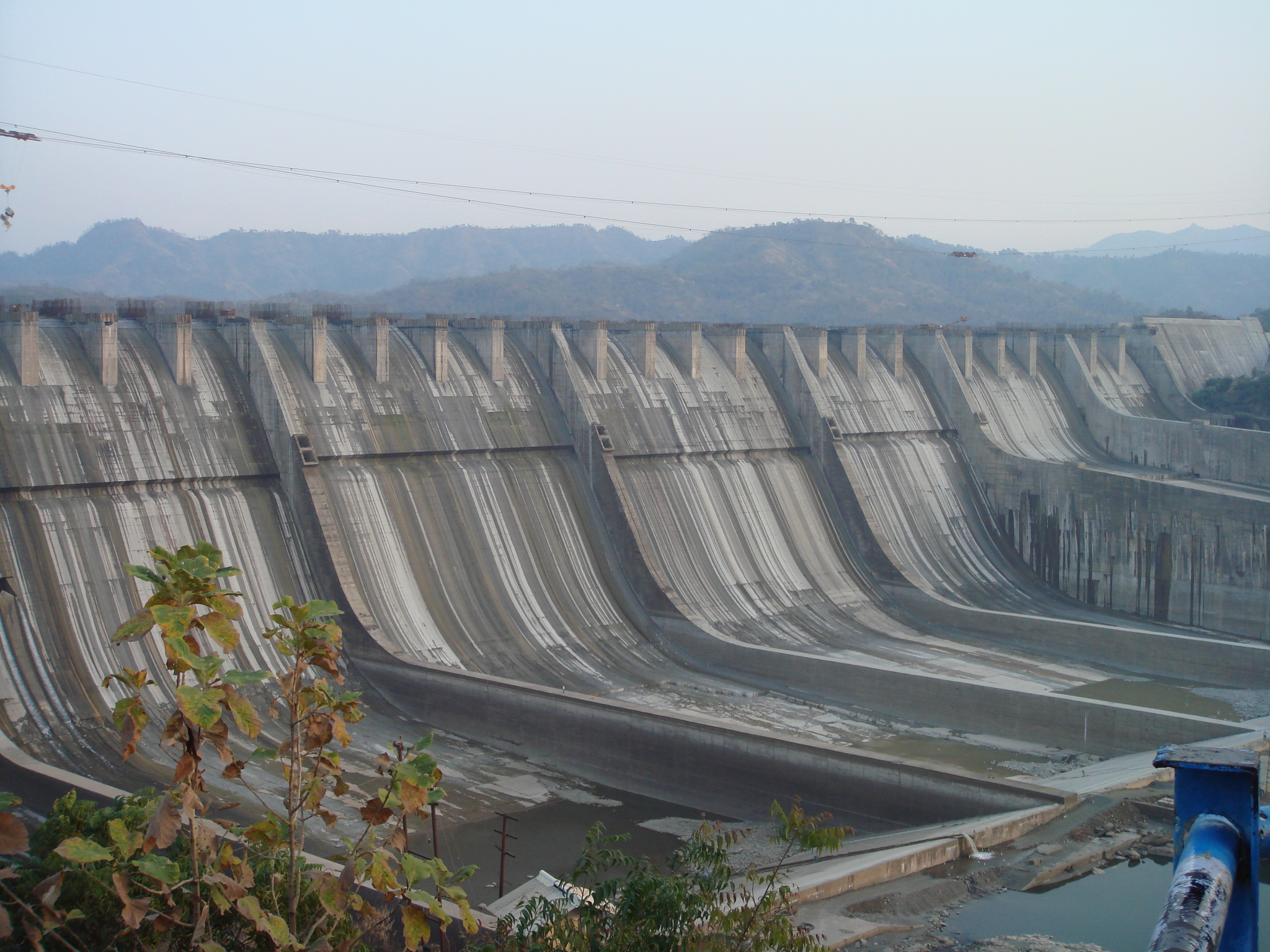
English: A photograph of the Sardar Sarovar Dam on the River Narmada, India, showing the principal spillway and construction underway for increasing the height from 110.64 metres to 121.92 as per clearance granted in March 2006. |
| दिनांक | |
| स्रोत | अपना कार्य |
| लेखक | AceFighter19 |
| कैमरा स्थान | | यह और अन्य आसपास की छवियों यहां पर देखें: ओपन स्ट्रीट मैप |
|---|
लाइसेंस
| मैं, इस कार्य का/की कॉपीराइट धारक, इस कार्य को सार्वजनिक डोमेन में प्रकाशित करता/करती हूँ। यह पूरे विश्व में लागू होता है। कुछ देशों में यह कानूनी तौर पर नहीं हो सकता है; ऐसा हो तो: मैं सभी को इस कार्य का इस्तेमाल किसी भी उद्देश्य से, बिना किसी बाधाओं के इन शर्तों के कानून द्वारा अनिवार्य किए तक करने की अनुमति देता/देती हूँ। |
चित्र का इतिहास
फ़ाइलका पुराना अवतरण देखने के लिये दिनांक/समय पर क्लिक करें।
| दिनांक/समय | थंबनेल | आकार | सदस्य | प्रतिक्रिया | |
|---|---|---|---|---|---|
| वर्तमान | 19:17, 8 जून 2009 | | 2,048 × 1,536 (1.38 MB) | AceFighter19 | {{Information |Description={{en|1=A photograph of the Sardar Sarovar Dam on the River Narmada, India, showing the principal spillway and construction underway for increasing the height from 110.64 metres to 121.92 as per clearance granted in March 2006.}} |
चित्र का उपयोग
निम्नलिखित पन्ने इस चित्र से जुडते हैं :
चित्र का वैश्विक उपयोग
इस चित्र का उपयोग इन दूसरे विकियों में किया जाता है:
- bn.wikipedia.org पर उपयोग
- en.wikipedia.org पर उपयोग
- es.wikipedia.org पर उपयोग
- fr.wikipedia.org पर उपयोग
- gu.wikipedia.org पर उपयोग
- he.wikipedia.org पर उपयोग
- hy.wikipedia.org पर उपयोग
- it.wikipedia.org पर उपयोग
- pt.wikipedia.org पर उपयोग
- ru.wikipedia.org पर उपयोग
- rw.wikipedia.org पर उपयोग
- tg.wikipedia.org पर उपयोग
- zh.wikipedia.org पर उपयोग