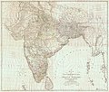
चित्र:Map of Hindoostan, 1788, by Rennell.jpg

इस पूर्वावलोकन का आकार: 702 × 600 पिक्सेल। दूसरे रेसोल्यूशन्स: 281 × 240 पिक्सेल | 562 × 480 पिक्सेल | 899 × 768 पिक्सेल | 1,199 × 1,024 पिक्सेल | 2,398 × 2,048 पिक्सेल | 14,638 × 12,501 पिक्सेल।
मूल चित्र ((14,638 × 12,501 पिक्सेल, फ़ाइल का आकार: 67.82 MB, MIME प्रकार: image/jpeg))
चित्र का इतिहास
फ़ाइलका पुराना अवतरण देखने के लिये दिनांक/समय पर क्लिक करें।
| दिनांक/समय | थंबनेल | आकार | सदस्य | प्रतिक्रिया | |
|---|---|---|---|---|---|
| वर्तमान | 13:27, 29 नवम्बर 2016 |  | 14,638 × 12,501 (67.82 MB) | Zhuyifei1999 | c:User:Rillke/bigChunkedUpload.js: Attempting to make thumb generation work, recompressed with imagemagick: $ convert Map_of_Hindoostan,_1788,_by_Rennell.jpg Map_of_Hindoostan,_1788,_by_Rennell.converted.jpg |
| 23:45, 12 अक्टूबर 2016 |  | 14,638 × 12,501 (66 MB) | Yann | c:User:Rillke/bigChunkedUpload.js: removed yellow tint | |
| 23:04, 12 अक्टूबर 2016 |  | 14,638 × 12,501 (14.72 MB) | Yann | {{Information |Description={{en|Map of India, 1788.}} |Source=http://pahar.in/indian-subcontinent-pre-1899/ |Date=1788 |Author={{Creator:James Rennell}} |Permission= |other_versions= }} Category:James Rennell Category:Maps of India [[Category:... |
चित्र का उपयोग
निम्नलिखित पन्ने इस चित्र से जुडते हैं :
चित्र का वैश्विक उपयोग
इस चित्र का उपयोग इन दूसरे विकियों में किया जाता है:
- ar.wikipedia.org पर उपयोग
- bn.wikipedia.org पर उपयोग
- cs.wikipedia.org पर उपयोग
- de.wikipedia.org पर उपयोग
- es.wikipedia.org पर उपयोग
- fr.wikipedia.org पर उपयोग
- he.wikipedia.org पर उपयोग
- or.wikipedia.org पर उपयोग
- uk.wikipedia.org पर उपयोग
- ur.wikipedia.org पर उपयोग


