
चित्र:Khaleej ajam.jpg
मूल चित्र ((400 × 618 पिक्सेल, फ़ाइल का आकार: 98 KB, MIME प्रकार: image/jpeg))
|
|
यह फ़ाइल विकिमेडिया कॉमन्स से है। वहाँ पर इसका विवरण पृष्ठ निम्नोक्त है। कॉमन्स मुक्त लाइसेंसों के अंतर्गत उपलब्ध मीडिया फ़ाइलों का संग्रह है। आप भी इसमें मदद कर सकते हैं। |
सारांश
| विवरण |
فارسی: نقشهٔ ایران در سال 1908 میلادی othoman map of mamlekat Ajam=persia
English: The map of the Persian Empire in 1908 Egypt library alazhar university |
|||||
| दिनांक | ||||||
| स्रोत | http://www.parssea.persianblog.ir | |||||
| लेखक | ibrahim. othoman maps | |||||
| अनुमति (इस चित्र का पुनः उपयोग करना) |
|
|||||
| दूसरे संस्करण | it has a explanation in the book [1] | |||||
The map of the Persia in 1908 .
लाइसेंस
- आप खुलकर:
- बाँट सकते हैं – रचना की प्रतिलिपि बना सकते हैं, बाँँट सकते हैं और संचारित कर सकते हैं
- रीमिक्स कर सकते हैं – कार्य को अनुकूलित कर सकते हैं
- निम्नलिखित शर्तों के अंतर्गत:
- श्रेय – यह अनिवार्य है कि आप यथोचित श्रेय प्रदान करें, लाइसेंस की कड़ी प्रदान करें, और अगर कोई बदलाव हुए हों तो उन्हें इंगित करें। आप ऐसा किसी भी उचित तरीके से कर सकते हैं, लेकिन किसी भी तरह उससे यह नहीं संकेत नहीं किया जाना चाहिए कि लाइसेंसधारी द्वारा आपको अथवा आपके इस प्रयोग का समर्थन किया जा रहा हो।
- समानसांझा – अगर आप इस रचना में कोई बदलाव करते हैं या इसपर आधारित कुछ रचित करते हैं तो आप अपने योगदान को सिर्फ इसी या इसके सामान किसी लाइसेंस के अंतर्गत बाँट सकते हैं।
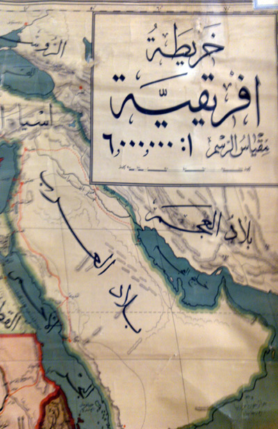
सारांश
| विवरण |
English: خلیج عــــــــجم |
||
| दिनांक | |||
| स्रोत | अपना कार्य | ||
| लेखक | Maahmaah | ||
| अनुमति (इस चित्र का पुनः उपयोग करना) |
or [4] [5] I, the copyright holder of this work, hereby publish it under the following license:free for use in public mass medi a i have also published it befor for free |
लाइसेंस
- आप खुलकर:
- बाँट सकते हैं – रचना की प्रतिलिपि बना सकते हैं, बाँँट सकते हैं और संचारित कर सकते हैं
- रीमिक्स कर सकते हैं – कार्य को अनुकूलित कर सकते हैं
- निम्नलिखित शर्तों के अंतर्गत:
- श्रेय – यह अनिवार्य है कि आप यथोचित श्रेय प्रदान करें, लाइसेंस की कड़ी प्रदान करें, और अगर कोई बदलाव हुए हों तो उन्हें इंगित करें। आप ऐसा किसी भी उचित तरीके से कर सकते हैं, लेकिन किसी भी तरह उससे यह नहीं संकेत नहीं किया जाना चाहिए कि लाइसेंसधारी द्वारा आपको अथवा आपके इस प्रयोग का समर्थन किया जा रहा हो।
- समानसांझा – अगर आप इस रचना में कोई बदलाव करते हैं या इसपर आधारित कुछ रचित करते हैं तो आप अपने योगदान को सिर्फ इसी या इसके सामान किसी लाइसेंस के अंतर्गत बाँट सकते हैं।
चित्र का इतिहास
फ़ाइलका पुराना अवतरण देखने के लिये दिनांक/समय पर क्लिक करें।
| दिनांक/समय | थंबनेल | आकार | सदस्य | प्रतिक्रिया | |
|---|---|---|---|---|---|
| वर्तमान | 10:26, 29 नवम्बर 2011 | | 400 × 618 (98 KB) | Maahmaah |
चित्र का उपयोग
निम्नलिखित पन्ने इस चित्र से जुडते हैं :
चित्र का वैश्विक उपयोग
इस चित्र का उपयोग इन दूसरे विकियों में किया जाता है:
- ar.wikipedia.org पर उपयोग
- arz.wikipedia.org पर उपयोग
- en.wikipedia.org पर उपयोग
- fa.wikipedia.org पर उपयोग
- fa.wikibooks.org पर उपयोग
- fr.wikipedia.org पर उपयोग
- ja.wikipedia.org पर उपयोग
- my.wikipedia.org पर उपयोग
- pnb.wikipedia.org पर उपयोग
- ro.wikipedia.org पर उपयोग
- ru.wikipedia.org पर उपयोग
- simple.wikipedia.org पर उपयोग
- sr.wikipedia.org पर उपयोग
- su.wikipedia.org पर उपयोग
- tg.wikipedia.org पर उपयोग
- tr.wikipedia.org पर उपयोग
- tt.wikipedia.org पर उपयोग
- uk.wikipedia.org पर उपयोग