
चित्र:Indian Ocean-CIA WFB Map.png
इससे बड़ा रेसोल्यूशन उपलब्ध नहीं हैं।
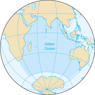
Indian_Ocean-CIA_WFB_Map.png ((330 × 330 पिक्सेल, फ़ाइल का आकार: 11 KB, MIME प्रकार: image/png))
|
|
यह फ़ाइल विकिमेडिया कॉमन्स से है। वहाँ पर इसका विवरण पृष्ठ निम्नोक्त है। कॉमन्स मुक्त लाइसेंसों के अंतर्गत उपलब्ध मीडिया फ़ाइलों का संग्रह है। आप भी इसमें मदद कर सकते हैं। |

|
This locator map image could be re-created using vector graphics as an SVG file. This has several advantages; see Commons:Media for cleanup for more information. If an SVG form of this image is available, please upload it and afterwards replace this template with
{{vector version available|new image name}}.
It is recommended to name the SVG file “Indian Ocean-CIA WFB Map.svg”—then the template Vector version available (or Vva) does not need the new image name parameter. |
सारांश
| विवरण |
English: Map of The Indian Ocean with English captions. |
|||
| दिनांक | ||||
| स्रोत | The World Factbook | |||
| लेखक | United States Central Intelligence Agency | |||
| अनुमति (इस चित्र का पुनः उपयोग करना) |
|
|||
| दूसरे संस्करण |
|


Derivative works
Derivative works of this file: Samudra Hindia.png
चित्र का इतिहास
फ़ाइलका पुराना अवतरण देखने के लिये दिनांक/समय पर क्लिक करें।
| दिनांक/समय | थंबनेल | आकार | सदस्य | प्रतिक्रिया | |
|---|---|---|---|---|---|
| वर्तमान | 09:14, 27 मार्च 2005 | | 330 × 330 (11 KB) | Wolfman~commonswiki | {{CIA-map}} |
चित्र का उपयोग
निम्नलिखित पन्ने इस चित्र से जुडते हैं :
चित्र का वैश्विक उपयोग
इस चित्र का उपयोग इन दूसरे विकियों में किया जाता है:
- am.wikipedia.org पर उपयोग
- ang.wikipedia.org पर उपयोग
- anp.wikipedia.org पर उपयोग
- as.wikipedia.org पर उपयोग
- azb.wikipedia.org पर उपयोग
- ba.wikipedia.org पर उपयोग
- be.wikipedia.org पर उपयोग
- bg.wikipedia.org पर उपयोग
- bh.wikipedia.org पर उपयोग
- bjn.wikipedia.org पर उपयोग
- blk.wikipedia.org पर उपयोग
- cdo.wikipedia.org पर उपयोग
- ckb.wikipedia.org पर उपयोग
- co.wikipedia.org पर उपयोग
- cs.wikipedia.org पर उपयोग
- dty.wikipedia.org पर उपयोग
- el.wikipedia.org पर उपयोग
- en.wikipedia.org पर उपयोग
- en.wikibooks.org पर उपयोग
- en.wikinews.org पर उपयोग
- en.wikisource.org पर उपयोग
- en.wikiversity.org पर उपयोग
- en.wiktionary.org पर उपयोग
- fa.wikipedia.org पर उपयोग
- fo.wikipedia.org पर उपयोग
- gor.wikipedia.org पर उपयोग
- gu.wikipedia.org पर उपयोग
- gv.wikipedia.org पर उपयोग
- hak.wikipedia.org पर उपयोग
- ha.wikipedia.org पर उपयोग
- he.wikipedia.org पर उपयोग
- hu.wikipedia.org पर उपयोग
- id.wikipedia.org पर उपयोग
इस चित्र के वैश्विक उपयोग की अधिक जानकारी देखें।