
चित्र:BlankMap-USA-states-Canada-provinces, HI closer.svg

पूर्वावलोकन PNG का आकार SVG फ़ाइल: 512 × 512 पिक्सेल दूसरे रेसोल्यूशन्स: 240 × 240 पिक्सेल | 480 × 480 पिक्सेल | 768 × 768 पिक्सेल | 1,024 × 1,024 पिक्सेल | 2,048 × 2,048 पिक्सेल।
मूल चित्र (SVG फ़ाइल, साधारणतः 512 × 512 पिक्सेल, फ़ाइल का आकार: 104 KB)
|
|
यह फ़ाइल विकिमेडिया कॉमन्स से है। वहाँ पर इसका विवरण पृष्ठ निम्नोक्त है। कॉमन्स मुक्त लाइसेंसों के अंतर्गत उपलब्ध मीडिया फ़ाइलों का संग्रह है। आप भी इसमें मदद कर सकते हैं। |
| विवरण |
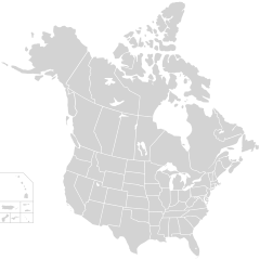
English: Blank SVG map of USA and Canada with state and province borders. Hawaii has been moved closer to the mainland USA to reduce width of image.
Non-contiguous parts of a states/provinces are "grouped" together with the main area of the state/provinces, so any state/provinces can be coloured in completion with one click anywhere on the state/provinces's area. Also, all states/provinces have a "id" attached to them, making them easy to find. Select "find" and then enter in the state/provinces's ISO 3166-2 code in the "id" field to find it. The codes can be found here (Canada) and here (USA). |
| दिनांक | |
| स्रोत |
|
| लेखक | Lokal_Profil |
| अनुमति (इस चित्र का पुनः उपयोग करना) |
इस फ़ाइल को क्रिएटिव कॉमन्स श्रेय-समानसांझा 2.5 साधारण लाइसेंस के अंतर्गत लाइसेंस किया गया है। श्रेय: Lokal_Profil
|
| दूसरे संस्करण |
This vector image includes elements that have been taken or adapted from this file:
The same as this map with the two-letter state or province name label for each one |
चित्र का इतिहास
फ़ाइलका पुराना अवतरण देखने के लिये दिनांक/समय पर क्लिक करें।
| दिनांक/समय | थंबनेल | आकार | सदस्य | प्रतिक्रिया | |
|---|---|---|---|---|---|
| वर्तमान | 01:48, 23 नवम्बर 2020 | | 512 × 512 (104 KB) | Ponderosapine210 | Accidentally uploaded wrong version. Here is the correct one. |
| 01:38, 23 नवम्बर 2020 |  | 512 × 596 (132 KB) | Ponderosapine210 | Added the prominent islands of Manitoulin (Ontario) and Isle Royale (Michigan) to the Great Lakes. | |
| 22:59, 1 जून 2019 |  | 512 × 512 (99 KB) | Fluffy89502 | added territories | |
| 21:18, 8 दिसम्बर 2007 |  | 1,730 × 1,730 (212 KB) | Lokal Profil | Code trimming | |
| 04:21, 3 जुलाई 2007 |  | 1,730 × 1,730 (213 KB) | Lokal Profil | {{Information |Description={{en|Blank SVG map of USA and Canada with state and province borders. Hawaii has been moved closer to the mainland USA to reduce width of image.}} Non-contiguous parts of a states/provinces are "grouped" together with the main a |
चित्र का उपयोग
इस चित्र से कोई पन्ने नहीं जुड़ते
चित्र का वैश्विक उपयोग
इस चित्र का उपयोग इन दूसरे विकियों में किया जाता है:
- en.wikipedia.org पर उपयोग
- fr.wikipedia.org पर उपयोग