"बैतूल": अवतरणों में अंतर
Content deleted Content added
Sanjeev bot (वार्ता | योगदान) छो बॉट: आंशिक लिप्यंतरण |
Sanjeev bot (वार्ता | योगदान) छो बॉट: साँचों में आँशिक लिप्यंतरण। |
||
| पंक्ति 19: | पंक्ति 19: | ||
| subdivision_type = Country |
| subdivision_type = Country |
||
| subdivision_name = India |
| subdivision_name = India |
||
| subdivision_type1 = [[ |
| subdivision_type1 = [[भारत के राज्य तथा केन्द्र-शासित प्रदेश|राज्य]] |
||
| subdivision_name1 = [[ |
| subdivision_name1 = [[मध्य प्रदेश]] |
||
| subdivision_type2 = [[ |
| subdivision_type2 = [[भारत के ज़िले|ज़िला]] |
||
| subdivision_name2 = [[Betul district|Betul]] |
| subdivision_name2 = [[Betul district|Betul]] |
||
| established_title = <!-- Established --> |
| established_title = <!-- Established --> |
||
| पंक्ति 43: | पंक्ति 43: | ||
| demographics_type1 = Languages |
| demographics_type1 = Languages |
||
| demographics1_title1 = Official |
| demographics1_title1 = Official |
||
| demographics1_info1 = [[ |
| demographics1_info1 = [[हिन्दी भाषा|हिन्दी]] |
||
| timezone1 = [[भारतीय मानक समय|IST]] |
| timezone1 = [[भारतीय मानक समय|IST]] |
||
| utc_offset1 = +5:30 |
| utc_offset1 = +5:30 |
||
| postal_code_type = <!-- [[ |
| postal_code_type = <!-- [[डाक सूचक संख्या|पिन]] --> |
||
| postal_code = |
| postal_code = |
||
| registration_plate = [[Vehicle registration plates of India|MP]] |
| registration_plate = [[Vehicle registration plates of India|MP]] |
||
14:58, 1 नवम्बर 2018 का अवतरण
| बैतूल | |
|---|---|
| नगर | |
| निर्देशांक: 21°54′18″N 77°54′07″E / 21.905°N 77.902°Eनिर्देशांक: 21°54′18″N 77°54′07″E / 21.905°N 77.902°E | |
| Country | India |
| राज्य | मध्य प्रदेश |
| ज़िला | Betul |
| ऊँचाई | 658 मी (2,159 फीट) |
| जनसंख्या (2011) | |
| • कुल | 1,03,330 |
| Languages | |
| • Official | हिन्दी |
| समय मण्डल | IST (यूटीसी+5:30) |
| आई॰एस॰ओ॰ ३१६६ कोड | IN-MP |
| वाहन पंजीकरण | MP |
| वेबसाइट | www |
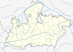
बैतूल, मध्य प्रदेश के बैतूल जिले में बाड़नूर से ५ किमी दूर इटारसी-नागपुर रेलमार्ग पर स्थित नगर है। यहाँ बरतन बनाना, चाँदी का काम, लाख की चूड़ियों का छोटे पैमाने पर काम होता है।

