
चित्र:Repuk Makalu Barun Valley Nepal.jpg

इस पूर्वावलोकन का आकार: 622 × 600 पिक्सेल। दूसरे रेसोल्यूशन्स: 249 × 240 पिक्सेल | 498 × 480 पिक्सेल | 797 × 768 पिक्सेल | 1,062 × 1,024 पिक्सेल | 1,980 × 1,909 पिक्सेल।
मूल चित्र ((1,980 × 1,909 पिक्सेल, फ़ाइल का आकार: 3.39 MB, MIME प्रकार: image/jpeg))
|
|
यह फ़ाइल विकिमेडिया कॉमन्स से है। वहाँ पर इसका विवरण पृष्ठ निम्नोक्त है। कॉमन्स मुक्त लाइसेंसों के अंतर्गत उपलब्ध मीडिया फ़ाइलों का संग्रह है। आप भी इसमें मदद कर सकते हैं। |
सारांश
| विवरण |
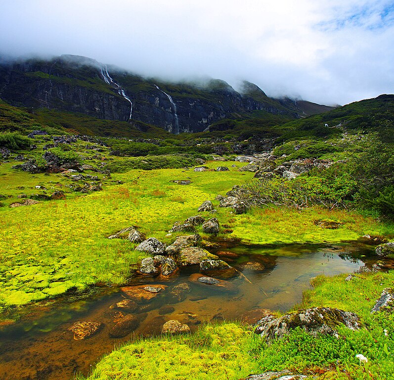
English: This is a place called Ripuk within the Barun Valley. Centuries ago, Barun used to be a glacier here, flowing to the north composing these lush green valleys for today. The cascading waterfalls against the stiff rocks was reflecting the sense of the flowing time and the eternity at the same time. |
| दिनांक | |
| स्रोत | अपना कार्य |
| लेखक | Dhilung |
| दूसरे संस्करण | https://www.flickr.com/photos/dhilung/3919034860/ |
| कैमरा स्थान | | यह और अन्य आसपास की छवियों यहां पर देखें: ओपन स्ट्रीट मैप |
|---|
लाइसेंस
मैं, इस कार्य का/की कॉपीराइट धारक, इसे निम्न लाइसेंस के अंतर्गत प्रकाशित करता/करती हूँ:
इस फ़ाइल को क्रिएटिव कॉमन्स श्रेय 3.0 अनरिपोर्टेड लाइसेंस के अंतर्गत लाइसेंस किया गया है।
- आप खुलकर:
- बाँट सकते हैं – रचना की प्रतिलिपि बना सकते हैं, बाँँट सकते हैं और संचारित कर सकते हैं
- रीमिक्स कर सकते हैं – कार्य को अनुकूलित कर सकते हैं
- निम्नलिखित शर्तों के अंतर्गत:
- श्रेय – यह अनिवार्य है कि आप यथोचित श्रेय प्रदान करें, लाइसेंस की कड़ी प्रदान करें, और अगर कोई बदलाव हुए हों तो उन्हें इंगित करें। आप ऐसा किसी भी उचित तरीके से कर सकते हैं, लेकिन किसी भी तरह उससे यह नहीं संकेत नहीं किया जाना चाहिए कि लाइसेंसधारी द्वारा आपको अथवा आपके इस प्रयोग का समर्थन किया जा रहा हो।
चित्र का इतिहास
फ़ाइलका पुराना अवतरण देखने के लिये दिनांक/समय पर क्लिक करें।
| दिनांक/समय | थंबनेल | आकार | सदस्य | प्रतिक्रिया | |
|---|---|---|---|---|---|
| वर्तमान | 22:20, 16 जनवरी 2010 | | 1,980 × 1,909 (3.39 MB) | Dhilung | Without watermark removed. GPS info embedded. |
| 06:31, 19 सितंबर 2009 |  | 2,150 × 2,078 (2.15 MB) | Dhilung | {{Information |Description={{en|1=This is a place called Ripuk within the Barun Valley. Centuries ago, Barun used to be a glacier here, flowing to the north composing these lush green valleys for today. The cascading waterfalls against the stiff rocks was |
चित्र का उपयोग
निम्नलिखित पन्ने इस चित्र से जुडते हैं :
चित्र का वैश्विक उपयोग
इस चित्र का उपयोग इन दूसरे विकियों में किया जाता है:
- bh.wikipedia.org पर उपयोग
- bn.wikipedia.org पर उपयोग
- de.wikipedia.org पर उपयोग
- dty.wikipedia.org पर उपयोग
- en.wikipedia.org पर उपयोग
- es.wikipedia.org पर उपयोग
- fa.wikipedia.org पर उपयोग
- fr.wikipedia.org पर उपयोग
- it.wikipedia.org पर उपयोग
- lt.wikipedia.org पर उपयोग
- mai.wikipedia.org पर उपयोग
- mk.wikipedia.org पर उपयोग
- ml.wikipedia.org पर उपयोग
- ne.wikipedia.org पर उपयोग
- pa.wikipedia.org पर उपयोग
- pnb.wikipedia.org पर उपयोग
- ru.wikipedia.org पर उपयोग
- sat.wikipedia.org पर उपयोग
- sa.wikipedia.org पर उपयोग
- sl.wikipedia.org पर उपयोग
- ta.wikipedia.org पर उपयोग
- th.wikipedia.org पर उपयोग
- tt.wikipedia.org पर उपयोग
- ur.wikipedia.org पर उपयोग
- vi.wikipedia.org पर उपयोग
- www.wikidata.org पर उपयोग