
चित्र:Halwell from near Moreleigh, South Devon - geograph.org.uk - 98894.jpg
इससे बड़ा रेसोल्यूशन उपलब्ध नहीं हैं।
Halwell_from_near_Moreleigh,_South_Devon_-_geograph.org.uk_-_98894.jpg ((640 × 480 पिक्सेल, फ़ाइल का आकार: 110 KB, MIME प्रकार: image/jpeg))
|
|
यह फ़ाइल विकिमेडिया कॉमन्स से है। वहाँ पर इसका विवरण पृष्ठ निम्नोक्त है। कॉमन्स मुक्त लाइसेंसों के अंतर्गत उपलब्ध मीडिया फ़ाइलों का संग्रह है। आप भी इसमें मदद कर सकते हैं। |
सारांश
| विवरण |
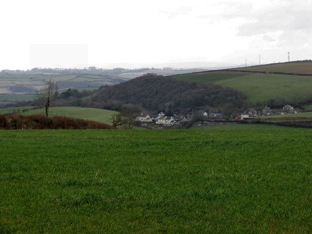
English: Halwell from near Moreleigh, South Devon. The small village of Halwell lies beside the busy A381 (Totnes to Kingsbridge). This photo shows how it nestles in the valley below the higher ground near Moreleigh. |
| दिनांक | |
| स्रोत | From geograph.org.uk |
| लेखक | Richard Knights |
| श्रेय (required by the license) | Richard Knights / Halwell from near Moreleigh, South Devon / |
| कैमरा स्थान | | यह और अन्य आसपास की छवियों यहां पर देखें: ओपन स्ट्रीट मैप |
|---|
_heading:22.00&language=hi)
| वस्तु स्थान | | यह और अन्य आसपास की छवियों यहां पर देखें: ओपन स्ट्रीट मैप |
|---|
_heading:22.00&language=hi)
लाइसेंस

|
This image was taken from the Geograph project collection. See this photograph's page on the Geograph website for the photographer's contact details. The copyright on this image is owned by Richard Knights and is licensed for reuse under the Creative Commons Attribution-ShareAlike 2.0 license.
|
इस फ़ाइल को क्रिएटिव कॉमन्स श्रेय-समानसांझा 2.0 साधारण लाइसेंस के अंतर्गत लाइसेंस किया गया है।
श्रेय: Richard Knights
- आप खुलकर:
- बाँट सकते हैं – रचना की प्रतिलिपि बना सकते हैं, बाँँट सकते हैं और संचारित कर सकते हैं
- रीमिक्स कर सकते हैं – कार्य को अनुकूलित कर सकते हैं
- निम्नलिखित शर्तों के अंतर्गत:
- श्रेय – यह अनिवार्य है कि आप यथोचित श्रेय प्रदान करें, लाइसेंस की कड़ी प्रदान करें, और अगर कोई बदलाव हुए हों तो उन्हें इंगित करें। आप ऐसा किसी भी उचित तरीके से कर सकते हैं, लेकिन किसी भी तरह उससे यह नहीं संकेत नहीं किया जाना चाहिए कि लाइसेंसधारी द्वारा आपको अथवा आपके इस प्रयोग का समर्थन किया जा रहा हो।
- समानसांझा – अगर आप इस रचना में कोई बदलाव करते हैं या इसपर आधारित कुछ रचित करते हैं तो आप अपने योगदान को सिर्फ इसी या इसके सामान किसी लाइसेंस के अंतर्गत बाँट सकते हैं।
चित्र का इतिहास
फ़ाइलका पुराना अवतरण देखने के लिये दिनांक/समय पर क्लिक करें।
| दिनांक/समय | थंबनेल | आकार | सदस्य | प्रतिक्रिया | |
|---|---|---|---|---|---|
| वर्तमान | 22:45, 30 जनवरी 2010 | | 640 × 480 (110 KB) | GeographBot | == {{int:filedesc}} == {{Information |description={{en|1=Halwell from near Moreleigh, South Devon. The small village of Halwell lies beside the busy A381 (Totnes to Kingsbridge). This photo shows how it nestles in the valley below the higher ground near M |
चित्र का उपयोग
निम्नलिखित पन्ने इस चित्र से जुडते हैं :
चित्र का वैश्विक उपयोग
इस चित्र का उपयोग इन दूसरे विकियों में किया जाता है: