
चित्र:N&SAmerica-pol.jpg
इस पूर्वावलोकन का आकार: 397 × 599 पिक्सेल। दूसरे रेसोल्यूशन्स: 159 × 240 पिक्सेल | 318 × 480 पिक्सेल | 964 × 1,455 पिक्सेल।
मूल चित्र ((964 × 1,455 पिक्सेल, फ़ाइल का आकार: 1.32 MB, MIME प्रकार: image/jpeg))
|
|
यह फ़ाइल विकिमेडिया कॉमन्स से है। वहाँ पर इसका विवरण पृष्ठ निम्नोक्त है। कॉमन्स मुक्त लाइसेंसों के अंतर्गत उपलब्ध मीडिया फ़ाइलों का संग्रह है। आप भी इसमें मदद कर सकते हैं। |
सारांश
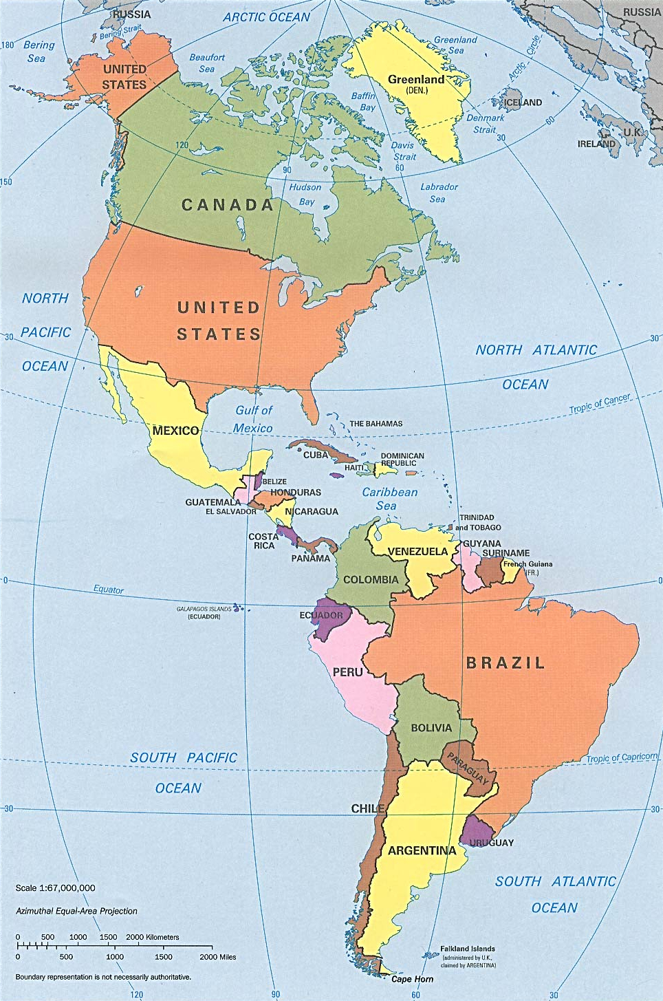
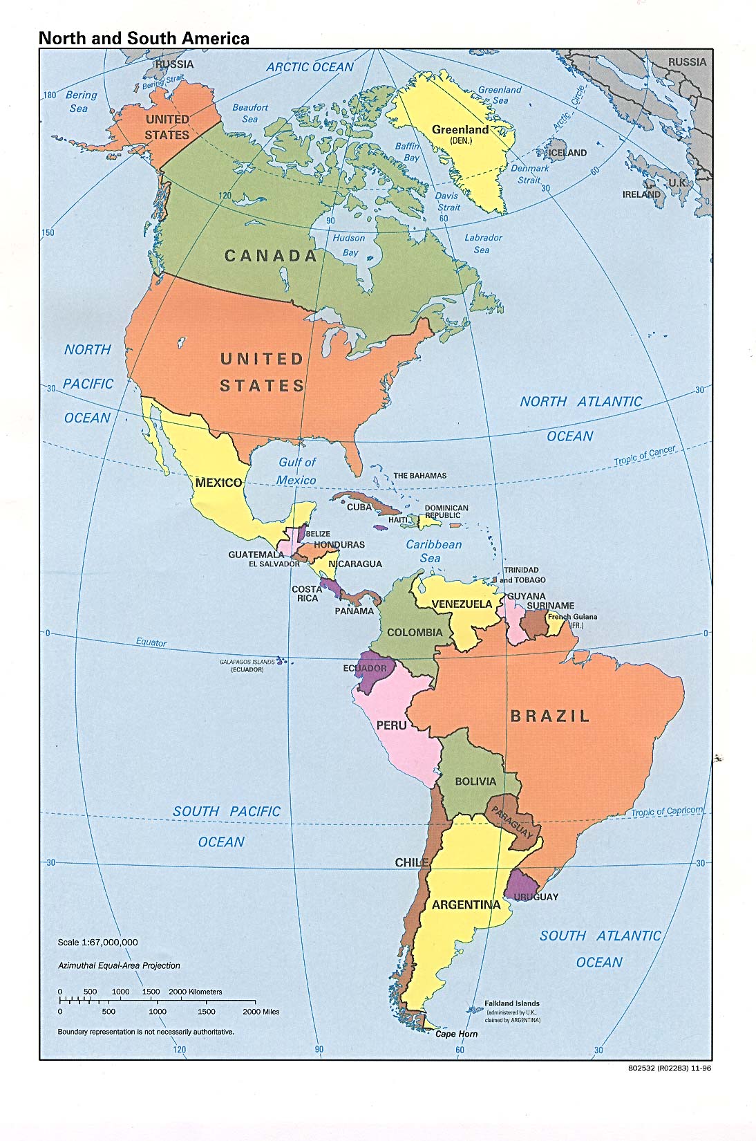
| विवरण | Americas with political boundaries |
| दिनांक | |
| स्रोत | http://www.lib.utexas.edu/maps/americas/americas_pol96.jpg |
| लेखक | CIA, original political map from Perry-Castañeda Library Map Collection; University of Texas Library Online |
लाइसेंस
| This image is a work of a Central Intelligence Agency employee, taken or made as part of that person's official duties. As a Work of the United States Government, this image or media is in the public domain in the United States.
|

|
चित्र का इतिहास
फ़ाइलका पुराना अवतरण देखने के लिये दिनांक/समय पर क्लिक करें।
| दिनांक/समय | थंबनेल | आकार | सदस्य | प्रतिक्रिया | |
|---|---|---|---|---|---|
| वर्तमान | 09:26, 22 जनवरी 2023 | | 964 × 1,455 (1.32 MB) | Lojwe | Cropped 1 % horizontally, < 1 % vertically using CropTool with precise mode. |
| 16:51, 12 जुलाई 2012 |  | 970 × 1,460 (1.29 MB) | McZusatz | cropped (used source file) | |
| 20:38, 10 जनवरी 2010 |  | 1,000 × 1,521 (286 KB) | Entheta | cropped | |
| 18:32, 25 मार्च 2007 |  | 1,094 × 1,650 (289 KB) | Corticopious | North and South America: political map (CIA) |
चित्र का उपयोग
निम्नलिखित पन्ने इस चित्र से जुडते हैं :
चित्र का वैश्विक उपयोग
इस चित्र का उपयोग इन दूसरे विकियों में किया जाता है:
- an.wikipedia.org पर उपयोग
- ar.wikipedia.org पर उपयोग
- as.wikipedia.org पर उपयोग
- az.wikipedia.org पर उपयोग
- az.wiktionary.org पर उपयोग
- ba.wikipedia.org पर उपयोग
- ceb.wikipedia.org पर उपयोग
- el.wikipedia.org पर उपयोग
- en.wikipedia.org पर उपयोग
- es.wikipedia.org पर उपयोग
- es.wikiversity.org पर उपयोग
- fa.wikipedia.org पर उपयोग
- fi.wikipedia.org पर उपयोग
- fr.wikipedia.org पर उपयोग
- fr.wiktionary.org पर उपयोग
- fy.wikipedia.org पर उपयोग
- he.wikipedia.org पर उपयोग
- hy.wikipedia.org पर उपयोग
- id.wikipedia.org पर उपयोग
- ig.wikipedia.org पर उपयोग
- ik.wikipedia.org पर उपयोग
- inh.wikipedia.org पर उपयोग
- it.wikipedia.org पर उपयोग
- ka.wikipedia.org पर उपयोग
- kcg.wikipedia.org पर उपयोग
- kk.wikipedia.org पर उपयोग
- km.wikipedia.org पर उपयोग
- kn.wikipedia.org पर उपयोग
- ko.wikipedia.org पर उपयोग
- la.wikipedia.org पर उपयोग
- lo.wikipedia.org पर उपयोग
- mk.wikipedia.org पर उपयोग
- ml.wikipedia.org पर उपयोग
- mn.wikipedia.org पर उपयोग
- mr.wikipedia.org पर उपयोग
- nds-nl.wikipedia.org पर उपयोग
- nl.wikipedia.org पर उपयोग
- no.wikipedia.org पर उपयोग
- pcd.wikipedia.org पर उपयोग
- pt.wikipedia.org पर उपयोग
- ru.wikipedia.org पर उपयोग
इस चित्र के वैश्विक उपयोग की अधिक जानकारी देखें।