
चित्र:Afghan-big.jpg

इस पूर्वावलोकन का आकार: 558 × 599 पिक्सेल। दूसरे रेसोल्यूशन्स: 223 × 240 पिक्सेल | 447 × 480 पिक्सेल | 715 × 768 पिक्सेल | 953 × 1,024 पिक्सेल | 1,378 × 1,480 पिक्सेल।
मूल चित्र ((1,378 × 1,480 पिक्सेल, फ़ाइल का आकार: 340 KB, MIME प्रकार: image/jpeg))
|
|
यह फ़ाइल विकिमेडिया कॉमन्स से है। वहाँ पर इसका विवरण पृष्ठ निम्नोक्त है। कॉमन्स मुक्त लाइसेंसों के अंतर्गत उपलब्ध मीडिया फ़ाइलों का संग्रह है। आप भी इसमें मदद कर सकते हैं। |
सारांश
| विवरण |
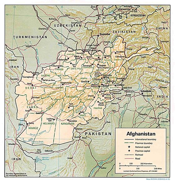
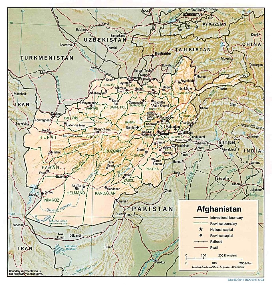
English: Map of Afghanistan |
|||||
| दिनांक | ||||||
| स्रोत | http://memory.loc.gov/cgi-bin/query/r?ammem/gmd:@field(NUMBER+@band(g7630+ct000721)) | |||||
| लेखक | United States Central Intelligence Agency | |||||
| अनुमति (इस चित्र का पुनः उपयोग करना) |
|
|||||
| दूसरे संस्करण | Derivative works of this file: Khyber Pass Area Map.jpg |


चित्र का इतिहास
फ़ाइलका पुराना अवतरण देखने के लिये दिनांक/समय पर क्लिक करें।
| दिनांक/समय | थंबनेल | आकार | सदस्य | प्रतिक्रिया | |
|---|---|---|---|---|---|
| वर्तमान | 23:24, 16 दिसम्बर 2006 | | 1,378 × 1,480 (340 KB) | Electionworld | {{ew|en|Ijomer}} Map of Afghanistan *CREATED/PUBLISHED: Central Intelligence Agency, 1993 *source: http://memory.loc.gov/cgi-bin/query/r?ammem/gmd:@field(NUMBER+@band(g7630+ct000721)) {{PD-USGov-CIA}} |
चित्र का उपयोग
निम्नलिखित पन्ने इस चित्र से जुडते हैं :
चित्र का वैश्विक उपयोग
इस चित्र का उपयोग इन दूसरे विकियों में किया जाता है:
- ar.wikipedia.org पर उपयोग
- azb.wikipedia.org पर उपयोग
- be.wikipedia.org पर उपयोग
- bjn.wikipedia.org पर उपयोग
- bn.wikipedia.org पर उपयोग
- de.wikivoyage.org पर उपयोग
- en.wikipedia.org पर उपयोग
- fo.wikipedia.org पर उपयोग
- id.wikipedia.org पर उपयोग
- kk.wikipedia.org पर उपयोग
- la.wikipedia.org पर उपयोग
- ml.wikipedia.org पर उपयोग
- ms.wikipedia.org पर उपयोग
- pl.wikipedia.org पर उपयोग
- ps.wikipedia.org पर उपयोग
- ru.wikipedia.org पर उपयोग
- simple.wikipedia.org पर उपयोग
- sq.wikipedia.org पर उपयोग
- uk.wikipedia.org पर उपयोग
- uz.wikipedia.org पर उपयोग